El Chorro is two things at once: the entrance to the Caminito del Rey, which is visited by thousands of people every day, and the leading climbing school in Andalusia, with nearly a thousand routes open.
And there are access restrictions that hardly anyone mentions. We’ll start with these, because they affect how you get there.
El Chorro is situated within the Desfiladero de los Gaitanes Nature Reserve, and that means specific rules:
This last point is important if you’re coming to go climbing: since the 2018 resolution of the Regional Environment Authority, Some of the classic routes are closed. Check the status of your sector before uploading, because the restrictions change.
Please park only in designated areas. During the high season at El Caminito, the car park gets very busy.

It is a hamlet in Álora, and the name is used to refer to the whole gorge area.
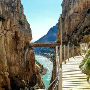
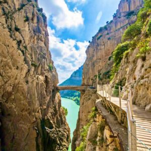
The Gaitanes Gorge is a canyon carved out of limestone by the River Guadalhorce, and the figures explain why it’s so impressive:
| Fact | Measure |
|---|---|
| Barrel length | 3 km |
| Wall height | Up to 300 m |
| Minimum width | Less than 10 m |
| Caves recorded | More than twenty |
Three hundred metres of wall, with a ten-metre gap. That’s what you see from the catwalks.

That’s why most people come to El Chorro, and quite rightly so.
The footbridges were built between 1914 and 1921 to supply power to hydroelectric power stations, and they are so called because Alfonso XIII crossed them in 1921 to inaugurate the Conde de Guadalhorce dam.
Practical information: 7.7 kilometres, three or four hours, one-way from north to south, limited capacity and a designated entry time. Tickets are selling out in season.
Full details at Tips for the Caminito del Rey, and if you’re travelling with children, how to do it with children.
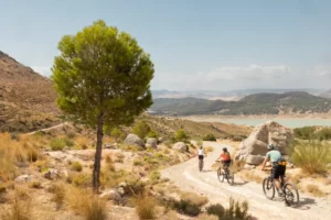
The footbridges are for pedestrian use. But the area is indeed suitable for cycling: there are sections of the Gran Senda de Málaga that are signposted for cyclists.
You can find it at The Caminito del Rey by bike.

This is what made El Chorro famous before the Caminito. It is Andalusia’s flagship school and one of the oldest in Spain.
| Fact | Figure |
|---|---|
| Open routes | Around 1,000 |
| Sectors | More than 80 including the extended area |
| Average height | 20 m |
| Maximum height | 230 m |
The rock is good-quality limestone, with vertical walls, overhangs, stalactites and drips.
And a practical tip: many routes are over 40 metres long, so A 70 rope is suitable. Journey times range from five minutes to over two hours, depending on the area.
It’s the newest thing in the area. Around the Ardales Reservoir and Las Encantadas there are already hundreds of routes between V1 and V10, in a mixture of sandstone and limestone.
El Chorro is a winter destination, and that’s what put it on the international map: when you can’t go climbing in the heart of Europe, you can here.
But there is a counterpoint: in winter Fog often shrouds the landscape and reduces visibility. Spring and autumn are the most reliable seasons.
And in summer, be careful in the sun: Even in winter, the sun beats down strongly on south-facing areas.

It’s the ideal choice for anyone who wants to experience the thrill of climbing a rock face without being a climber. The tour is led by a guide, equipment is provided, and no previous experience is required.
The El Chorro via ferrata can be combined with the Caminito on the same day – that’s the most popular option.

As well as the Caminito, there are other routes that do not require an admission fee or booking:
Once a year, at the end of the Caminito, the Chorro Beer Fest is held: craft beer, live music and food, on the esplanade next to the gorge.
And it works well when combined: A short walk in the morning, a festival in the afternoon.
Full details at El Chorro Beer Fest: what it’s like, how to get there, and whether it’s suitable for children.
Please remember that the Monte Haza del Río track is closed to vehicles all year round.
Places are limited and are filling up, because the village is small and there are a lot of visitors to El Caminito.
There are accommodation options catering to climbers —hostels and country cottages— and a few restaurants near the station and around the reservoir.
In more detail: Where to eat at the Caminito del Rey.
To continue: What to see in Ardales y What to see in Antequera.
We are a local tour operator based in Málaga with over 50 years’ experience organising trips around Andalusia.
The problem with El Chorro is access: Limited public transport, overcrowded car parks and capacity restrictions at the entrances to El Caminito. An organised outing solves all three problems.
A village in the municipality of Álora, in Málaga, whose name is used to refer to the entire area of the Desfiladero de los Gaitanes. It is the gateway to the Caminito del Rey and, at the same time, Andalusia’s most important climbing area, with nearly a thousand routes open. The gorge is a three-kilometre-long canyon with walls up to three hundred metres high and a width of less than ten metres.
Yes, and it is one of Europe’s leading destinations, with nearly a thousand routes spread across more than eighty limestone sectors. However, there are restrictions: following the 2018 resolution by the Regional Environment Authority, some of the historic routes have been closed due to the presence of endangered species on the cliffs, so it is advisable to check the status of the sector before climbing.
Not everyone. Motor vehicles are prohibited from using the Monte Haza del Río track all year round, as this is the access route to the Paredes Frontales sectors: you must go on foot. Nor is it permitted to access the routes by crossing the Málaga–Bobadilla railway line, which is in use.
Spring and autumn are the most reliable seasons. El Chorro became famous as a winter climbing destination because the weather allows climbing when it is not possible in central Europe, but at that time of year fog frequently blankets the area and reduces visibility. In summer, the sun beats down on the south-facing sectors.
Plenty: explore the three reservoirs on the Guadalhorce on foot or by bike, walk stage 20 of the Gran Senda de Málaga, climb up to the Mesa de Villaverde viewpoint, or tackle a via ferrata with a guide. And if it’s the right time of year, the craft beer festival held at the exit of the gorge.
Travelling by train is the most convenient option: El Chorro-Caminito del Rey station provides connections to Málaga, Seville and Ronda, and drops you right in the heart of the area. By car, it takes about fifty minutes from Málaga, although the car park gets very full during the Caminito’s high season.